The Stones Were Talking — Settlers and Indigenous Guides Knew How to Listen
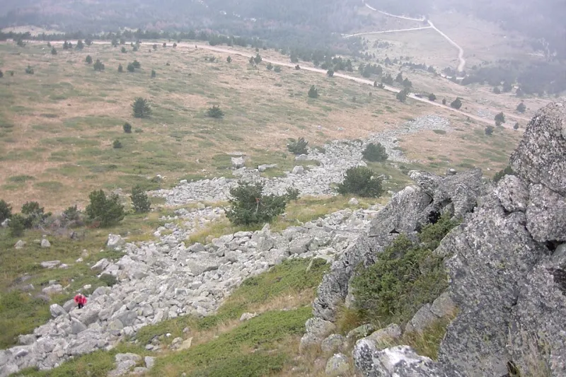
Photo: john melekidis, CC BY-SA 3.0, via Wikimedia Commons
Pick up a smooth stone from the edge of a river and you're holding a record. Not a metaphor — an actual record. The color tells you something about the minerals upstream. The shape tells you about the current's speed and history. The coating on its surface, if you know what to look for, can tell you whether a flood came through recently, whether the water table nearby is rising, and in some cases, whether the weather is about to change.
For most of human history, people who spent time outdoors knew how to read that record. Today, almost nobody does.
A Science Before Science Had a Name
The practice of reading geological formations to understand weather, water, and seasons doesn't have a tidy historical name, which is part of why it's been so easy to overlook. It wasn't a formal discipline. It was embedded in the everyday knowledge of settlers, farmers, Indigenous guides, and anyone else whose survival depended on understanding the land beneath their feet.
Indigenous peoples across North America developed extraordinarily detailed systems for reading landscape as a source of information. The Lakota, for instance, had specific knowledge about how certain rock formations indicated underground water sources — knowledge that guided movement across the Great Plains long before European settlers arrived. The Diné (Navajo) used mineral coloration in canyon walls to identify seasonal forage patterns and predict where grazing would be viable after winter. These weren't isolated insights. They were parts of integrated, intergenerational knowledge systems that treated geology as a living language.
European settlers, many of whom arrived from agricultural traditions that included their own forms of land reading, absorbed some of this knowledge through contact with Indigenous guides and through hard-won experience. By the 1800s, a working understanding of what stones and soil could tell you was considered basic practical literacy for anyone spending time in unfamiliar territory.
What the Stones Actually Say
So what does stone reading actually look like in practice? Some of it is surprisingly accessible.
Water-smoothed stones in a dry riverbed, for example, can indicate how recently water moved through and how fast it was traveling — information that's directly relevant to flash flood risk, which remains one of the leading causes of weather-related deaths in the American Southwest. The presence of certain iron-rich minerals, which show up as rust-orange staining on exposed rock, can point toward underground springs even in apparently arid terrain. Early settlers crossing the desert West learned to watch for these markers as reliable indicators of where to dig.
Weather prediction through stone observation is more subtle but equally documented. Many rocks are slightly porous, and in the hours before a significant drop in barometric pressure — which typically precedes a storm — they can absorb atmospheric moisture and appear subtly darker or feel damp to the touch. Experienced outdoorspeople in pre-instrument America treated this as a reliable early warning. It's not magic. It's physics.
There's also the matter of lichen. The patterns and species of lichen growing on exposed stone can indicate prevailing wind direction, average moisture levels, and even air quality — information that, when read correctly, gives a picture of a location's typical weather patterns over decades rather than days.
Why It Almost Vanished
The short answer is that instruments got better. The barometer, the thermometer, and eventually satellite forecasting made the slow, observational practice of reading landscape feel obsolete. Why spend years learning to decode a riverbed when you could check a gauge?
The longer answer involves what gets lost when a knowledge system stops being transmitted. Stone reading wasn't just about weather prediction. It was a form of what educators now call "land literacy" — a deep, embodied understanding of how a particular place works, built through sustained attention over time. When that practice stopped being passed down, people didn't just lose a weather forecasting method. They lost a whole way of being in relationship with the landscape.
The Quiet Revival
Outdoor education programs across the country have started to notice the gap. Wilderness schools in places like Colorado, Oregon, and the Appalachian region have begun incorporating stone and soil reading into their curricula — not as a novelty, but as a foundational skill for anyone spending serious time in backcountry environments.
Some of this revival is happening in collaboration with Indigenous knowledge keepers who have maintained these practices continuously, even when the broader culture wasn't interested. Organizations focused on Indigenous land stewardship have been particularly active in framing geological literacy as a form of cultural preservation as much as an outdoor skill.
The students who come through these programs often describe the experience as a kind of perceptual shift. The landscape stops being scenery and starts being text. A hillside isn't just pretty — it's a document. A streambed isn't just a streambed — it's a weather forecast, a water map, a seasonal calendar.
That shift, it turns out, is something instruments can't provide. And once you've made it, it's hard to walk through a landscape the same way again.